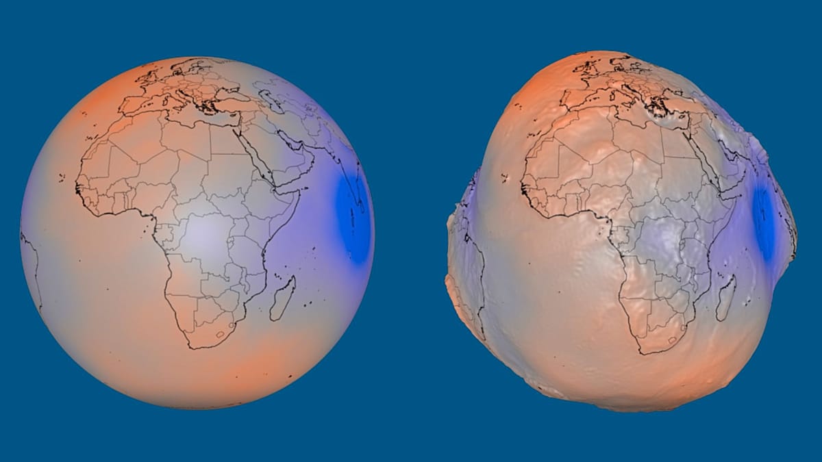
Gravity doesn’t pull evenly across our planet, and guess what? That little fact has a visible impact on how Earth looks! This summer, NASA dropped a visual treat on us, showcasing these differences in a way that really grabs your attention. Imagine if our oceans were just sitting there, untouched by tides, waves, winds, or currents—shaped solely by gravity and Earth’s rotation. You’d see a surface that’s not just a smooth sphere, but one with subtle bulges and dips. Crazy, right? NASA’s latest visualization cranks up those differences by a whopping factor of 10,000, making our home planet appear like an uneven potato!
Now, what’s this geoid thing we keep hearing about? Well, it’s a mathematical model of Earth’s gravitational field, representing an imaginary sea level that stretches across the entire globe, even beneath the continents. But don’t get it twisted—it’s not the actual shape of the Earth’s surface. Picture this: mass isn’t distributed evenly inside our planet, and that creates an uneven gravitational field. Mountains, ocean trenches, and variations in material density all play their part. Areas with extra mass pull water toward them, which leads to those imaginary rises in the geoid. In other spots, the theoretical sea level dips lower, creating depressions.
In this stunning visualization, the variations in the geoid’s height are exaggerated, but the reality is still quite interesting. The difference between the highest and lowest points is actually 191 meters! Can you believe that? The geoid peaks 85 meters above the reference level around Iceland and dives 106 meters below it south of India. The reference level itself is a smoothly flattened model of Earth that serves as a baseline for measuring these variations.
What’s even cooler is that this visualization is based on over a billion observations collected by 19 satellites over 15 years. Yes, you heard that right—15 years! Among them are NASA’s Gravity Recovery and Climate Experiment and the European Space Agency’s Gravity Field and Steady-State Ocean Circulation Explorer. Scientists are using the geoid to study how Earth’s gravitational field changes as water, ice, and other masses shift around. According to NASA, this info is super important for things like ping, surveying, and navigation. It’s wild to think about how something as basic as gravity can reveal so much about our planet, isn’t it?
Where will this newfound knowledge take us? We’ll just have to stay tuned and watch as scientists continue to explore this fascinating aspect of our world. The more we know, the better we can understand the forces shaping our planet every day.
Kaynak: Orijinal Haber