
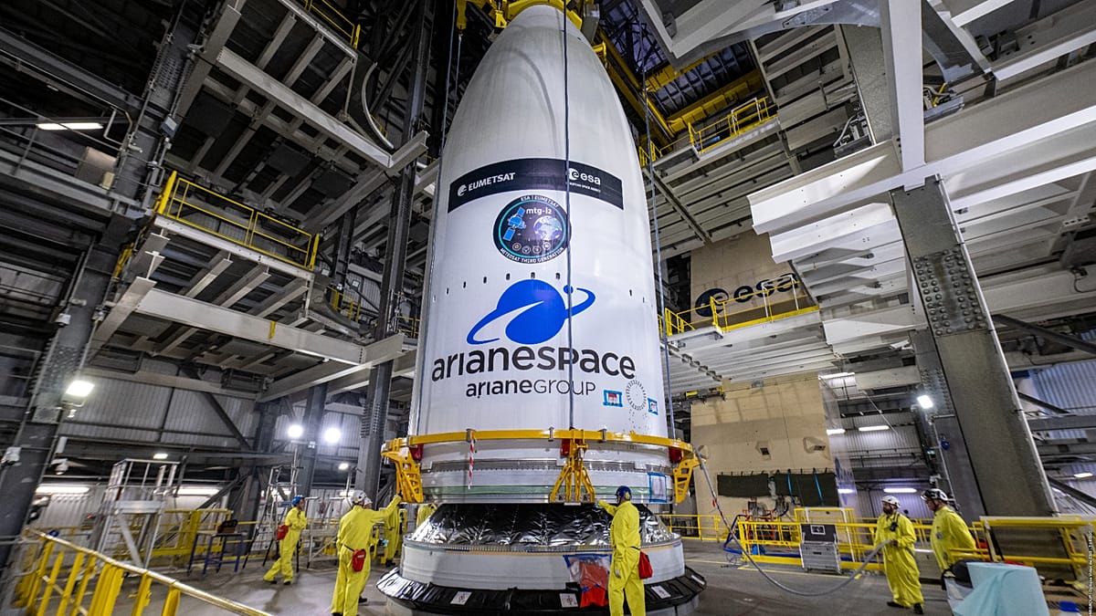
After two flights and more than 7,000 kilometres from Paris, Europe has taken a significant leap in space technology with the successful launch of a state-of-the-art satellite designed to monitor the Earth’s surface. This satellite aims to enhance disaster prevention strategies, helping to mitigate the floods and fires that have increasingly devastated countries across the continent. The heart of this operation isn’t found on the launch pad, but rather in a windowless control room located several kilometers away, where we were welcomed by the deputy launch director, Frédéric, who, for security reasons, we won’t name, along with a team of engineers ready to share the milestone’s intricate details.
Now, what’s fascinating is the rocket that is about to place this new European weather satellite into orbit was built with a very clear goal: to be cheaper and more versatile than its predecessor, the Ariane 5. And let’s face it, the international competition has gotten a lot tougher over the past decade. The engineers told us that the secret lies in where each task is performed. The core stage of the Ariane 6 is manufactured and fully tested in France, while the upper stage comes from Germany. Once they arrive in Guiana, they’re already “ready to fly.”
You see, it’s much more practical to manufacture the boosters right there rather than shipping propellant from Europe. But filling the launcher? That’s no quick pit stop at the gas station—oh no! It takes a solid two hours to fill, followed by an hour and a half for thermal stabilization. Why? Because we’ve got liquid oxygen at a chilling -150°C and liquid hydrogen at an even frostier -250°C. And believe it or not, it’s not a fully automatic process. There are many steps that the staff need to check and validate before moving on to the next automated sequence. We can’t just pop open the container and let it fly out, right?
Now, the weather conditions are critical. Rain or temperature? Not much of a concern. But thunderstorms and wind—both at the surface level and at altitude—are the real game changers. The stakes are high; in the past five years alone, Europe has faced losses of about 10 billion euros a year due to damages from natural disasters, leading to thousands of deaths. Thankfully, as our forecasting and warning systems improve, the number of fatalities is decreasing, but the damage to infrastructure remains a pressing issue. We really need to be more resilient.
This satellite’s frequency is crucial for local weather forecasting across Europe and the Mediterranean, but it’s also vital for civil protection—think firefighters detecting wildfires, droughts, or even those increasingly violent Mediterranean tornadoes. Bank estimates suggest that the new satellite will take about half a year to commission before it can be integrated and calibrated with its two siblings. By around April 2027, these three satellites will operate as a cohesive system.
Graeme Mason, head of meteorological programs at ESA, shared some eye-popping figures that make MTG-I2 one of the most advanced observation instruments ever put into orbit. The first satellite in this family scans the entire visible Earth disc every ten minutes, with a resolution of 500 meters—around 500 million pixels per full sweep, distributed across 16 channels. Meanwhile, MTG-I2 will zero in on the upper quadrant centered on Europe, repeating the scan every 150 seconds. It’s got a second instrument too, a lightning detector that works in a narrow band of the spectrum, taking 1,000 samples per second. To resolve features as small as 500 meters from an orbit 36,000 kilometers up, the satellite needs to maintain extreme stability across its three axes.
This whole program showcases the strength of the European aerospace industry, involving over 17 countries and 70 companies, with more than 200 subcontracts and over 2,200 people working tirelessly on the project. Talk about teamwork! They say this image generator is the best geostationary imager and lightning imager in the world, surpassing even American technology. In the next decade, ESA plans to send out the next family of satellites to keep leading the charge in climate monitoring and analysis.
So, as we moved between the Ariane 6 control room, the satellite encapsulation facility, and the weather station tracking clouds over Kourou, it was clear that launching MTG-I2 was a culmination of countless technical decisions made by teams who often don’t get their moment in the spotlight. With this satellite now in orbit, Europe has completed the first operational trio of its third-generation meteorological constellation, setting the stage for climate monitoring well into the 2040s. What’s next for European space exploration? Only time will tell…
Kaynak: Orijinal Haber